 The aim in this series of books is to provide the mountainbiker and walker with information on a variety of routes so they know something of what to expect. One of the problems is that O.S. maps give no indication as to whether an 'other road' is metalled, a path or a forest fire break, or anything in between. Many bridges shown on O.S. maps do not exist. Rivers are difficult to judge in size from the map, and a building may be anything from a pile of stones to a maintained bothy. All is revealed without removing the sense of adventure and exploration. Gradient profiles help to assess how strenuous a route is, and each hand-drawn page contains a wealth of information. The object is to save wasted leisure time and enable the armchair explorer to plan ahead or relive experiences. "The Atholl Glens" includes: The Glens East of Drumochter, Glen Tilt to Cairnwell, and Aberfeldy to Dunkeld.
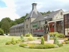
More Perthshire books
Thursday, 29 March 2007
A Personal Survey of the Atholl Glens for Mountainbikers and Walkers
Subscribe to:
Post Comments (Atom)
No comments:
Post a Comment